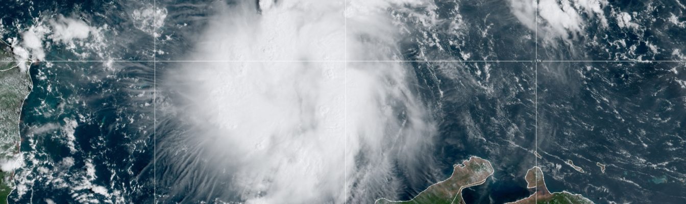
Cuba issues tropical cyclone warning as Ian slowly strengthens

Gavin Riley / Our Today
administrator
A tropical cyclone warning issued by the Instituto de Meteorología de la República de Cuba (INSMET) leaves all three Caribbean territories in the crosshairs of newly formed Tropical Storm Ian on high alert as the system slowly organises and intensifies today (September 24).
The tropical storm watch and hurricane watch activated by the Jamaica Meteorological Service and Cayman Islands National Weather Service remain in effect.
Becoming the ninth named cyclone of the 2022 North Atlantic Hurricane Season, Tropical Storm Ian formed around 11:00 pm Friday.
According to the latest bulletin from the US-based National Hurricane Center (NHC) as at 8:00 am Eastern Daylight Time (EDT), the centre of TS Ian was located near latitude 14.2 North and longitude 74.5 West.
Ian, roughly 485 kilometres south-southeast of Jamaica’s capital Kingston, is tracking west-southwest at a brisk 24 kilometres/hour. The system currently packs a slightly heavier punch, as its maximum sustained winds hover around 75 kilometres/hour, with higher gusts.

What’s more, tropical-storm-force winds extend outward up to 75 kilometres from its centre.
In its projections, the NHC anticipates Ian to continue barrelling across the warm waters of the central Caribbean Sea today, making a glancing pass at Jamaica before a near-direct hit on Grand Cayman and western Cuba.
“On the forecast track, the centre of Ian is forecast to pass southwest of Jamaica on Sunday and pass near or over the Cayman Islands Sunday night and early Monday. Ian will then approach western Cuba on Monday,” the hurricane watchdog advised.
“Strengthening is forecast during the next few days, and Ian is expected to become a hurricane late Sunday or Sunday night,” the Miami-headquartered NHC added.
For its part, the Jamaica Met Sevice said that eastern and southern parishes will face the brunt of Tropical Storm Ian as it churns past the island as early as Saturday afternoon into Sunday.

“Flash flooding is therefore likely over low-lying and flood-prone areas during the remainder of the weekend and on Monday,” the Jamaican agency indicated in an 8:00 am bulletin.
The Met Service also noted that all small craft operators, including fisherfolk and other marine interests, are advised to stay anchored in “safe harbour until warning messages have been lifted and wind and sea conditions have returned to normal”.
READ MORE:
- Take heed! Holness urges Jamaicans to prepare amid severe weather alert
- Jamaica, Cayman and Cuba in crosshairs as Tropical Depression Nine forms
- Alert levels raised in Jamaica & Cayman as TD Nine brews





Comments