
Emily, Franklin and Gert all form; two more disturbances to join quintuple Atlantic mayhem

/ Our Today
administrator
In what has been a busy and most chaotic weekend for meteorologists, the US-based National Hurricane Center (NHC) continues to monitor the progression of five disturbances in the tropical Atlantic today (August 21), three of which now bear cyclonic properties.
Tropical Depression Six was the first to roar to life on Saturday afternoon, and while it initially struggled to stabilise amid strong westerly wind shears, strengthened into Tropical Storm Gert just before midnight. NHC sleuths maintain that Gert will be a short-lived system and already shows signs of unravelling on Monday and should disspate tomorrow morning.
At as 5:00 am Atlantic Standard Time (AST), Gert’s centre was located near latitude 16.7 North, longitude 56.4 West—or some 730 kilometres east-southeast of the northern Leeward Islands. Tropical Storm Gert is packing maximum sustained winds near 65 kilometres/hour, with higher gusts.

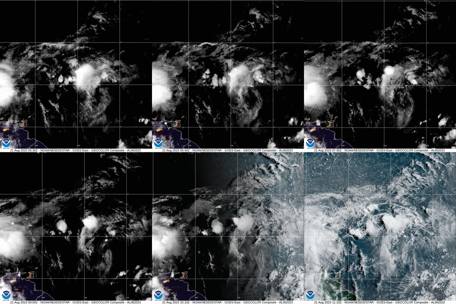
Tropical-storm-force winds extend outward up to 110 kilometres from its centre, as it is continues to track west near 15 kilometres/hour.
In the roughly 24 hours left in Gert’s remaining lifecycle, according to NHC projections, the storm isn’t expected to directly threaten landmasses in the Eastern Caribbean, with no coastal watches or warnings currently in effect.
Tropical Storm Emily, formerly InvestAL99, entered the fray around 9:30 am Eastern Standard Time (EST) on Sunday and has since weakened slightly.

Satellite imagery pinpoints the centre of Emily near latitude 20.7 North, longitude 41.1 West—or 1,875 kilometres west-northwest of the Cabo Verde Islands.
With maximum sustained winds dropping to 65 kilometres/hour, with higher gusts, the Miami-based hurricane watchdog is anticipating urther weakening as Emily could become a post-tropical cyclone by Monday evening.
As tropical-storm-force winds extend outward up to 335 kilometres from its centre, Emily, the eighth system of the 2023 Hurricane Season, also poses no direct threat to land.

In quick succession, Tropical Storm Franklin entered the fray on Sunday afternoon after dumping inches of rain on Trinidad. Feeding off the warm waters of the northeastern Caribbean Sea, the system, formerly desginated Invest90L, has already triggered tropical storm warnings for southern Hispaniola.
Additionally, the governments of the Dominican Republic, Haiti and the Turks and Caicos Islands have all activated tropical storm watches, with the Bahamas and Puerto Rico being cautious, as Franklin increasingly shifts north toward the Greater Antilles.

As at 8:00 am AST on Monday, Franklin’s centre was located some 380 kilometres south of Santo Domingo—near latitude 15.1 North, longitude 69.6 West.

Franklin is moving west to west-northwestward and is projected to turn north on a beeline for Hispaniola into tonight. On the forecast track, further strengthening is likely for the tropical storm though it could hit the island just shy of hurricane intensity.
Maximum sustained winds now hover around 85 kilometres/hour, with higher gusts, as tropical-storm-force winds extend outward up to 60 miles 95 kilometres from the centre.
Often targeted Haiti and the Dominican Republic may be affected by strong winds, high surf and isolated rainfall maximums up to 15 inches, if NHC forecasts pan out. Franklin’s direct influence on land is expected to subside around Thursday as it heads back out into the open Atlantic.

For the time being, Franklin poses no direct threat to Jamaica.
There is already talk among meteorologists of ‘Harold’, currently desginated Invest91L, joining the buzz in activity in the warm Gulf of Mexico.
According to the NHC, InvestAL91’s broad area of low pressure exhibits signs of greater organisation over the central Gulf of Mexico.
“Environmental conditions appear conducive for development of this system, and a tropical depression or tropical storm is likely to form before it reaches the western Gulf of Mexico coastline on Tuesday. Interests in southern Texas and northern Mexico should monitor the progress of this system as tropical storm watches or warnings are likely to be issued later today,” the NHC advised in its tropical weather outlook.
Formation chances are listed as ‘high’ at 80 per cent over the next two-to-seven days.
Finally, just off the West African coast lies InvestAL92, a tropical wave which has met favourable environmental conditions.

The NHC warned that the system is poised to gradually develop, birthing a new a tropical depression as early as mid-week on a west-northwestward path across the eastern tropical Atlantic.
Its chances at further strengthening sit at a ‘medium’ 40 per cent in the next 48 hours and ‘high’ over the next seven days.
The next two available names are Harold and Idalia.




Comments