
Hurricane Sam inching away from the Caribbean, more trouble emerges off African coast

Gavin Riley / Our Today
administrator
Meteorologists tracking Hurricane Sam are expecting the category four storm to miss most of the Caribbean entirely, even as three other disturbances present varying levels of concern on Monday (September 27).
The US-based National Hurricane Center (NHC), in a 5:00 am Atlantic Standard Time (AST) bulletin, noted that Sam is nothing to scoff at, however, as it anticipates the menacing storm to remain at major hurricane strength for the next several days.
There are no coastal watches or warnings activated at this time for lands across the Caribbean.
“Little change in strength is expected during the next day or so. Thereafter, some slow weakening is forecast through midweek, although Sam should remain a major hurricane,” the NHC noted.
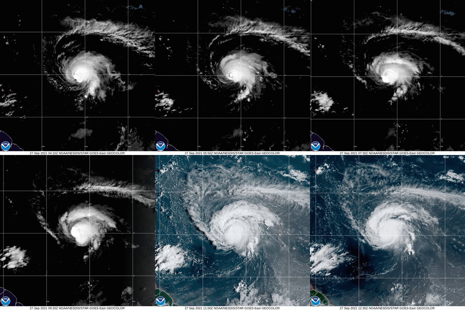
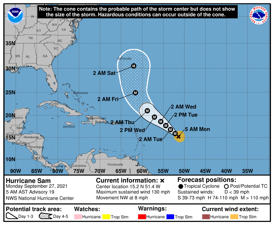
As at 5:00 am AST, the centre of Hurricane Sam was located near latitude 15.2 North, longitude 51.4 West—or roughly 1,290 kilometres east-southeast of the northern Leeward Islands.
Sam, a small major hurricane, has weakened slightly from its peak intensity on Sunday, but still pack a ferocious punch with maximum sustained winds swirling at 215 kilometres/hour, with higher gusts.
Hurricane Sam is moving toward the northwest near 13 kilometres/hour; while hurricane-force winds extend outward up to 45 kilometres from the centre and tropical-storm-force winds extend outward up to 165 kilometres.
In the meantime, sleuths at the NHC are also closely monitoring three other potential systems that may pose a threat to the region in the coming days.
The first disturbance is an elongated area of low pressure associated with the remnants of tropical depression Peter located a few hundred miles east-southeast of Bermuda.
While showers and thunderstorms activity has changed little in organisation since yesterday, environmental conditions are listed as “marginally conducive” for some redevelopment, and Peter could briefly become a tropical depression again over the next two days.
The remnants of Peter are moving northeastward near 16 kilometres/hour, however, by midweek, environmental conditions are expected to become unfavourable for further growth.
Formation chances through the next two to five days are at a “medium”, 50 per cent respectively.
The second area of concern is a broad area of low pressure located several hundred miles southwest of the Cabo Verde Islands—producing disorganised showers and thunderstorms.
Environmental conditions are forecast to be conducive for further development of this disturbance, and a tropical depression is likely to form in a few days while it moves westward to west-northwestward over the central tropical Atlantic.
The NHC places chances for further intensification over the next two to five days respectively between 40 and 80 per cent.

The third disturbance is a tropical wave moving offshore from continental Africa into the warm waters of the western Atlantic Ocean.
Upper-level winds are forecast to be favourable for gradual development, and a tropical depression is likely to form in a few days while the system moves westward to west-northwestward over the far eastern tropical Atlantic.
The hurricane watchdog indicated that formation chances through the next two to five days respectively are 40 and 80 per cent.
Only two names remain on the 2021 North Atlantic Hurricane Season, which ends on November 30, Wanda and Victor—pointing to this year needing a supplementary list, like the record-breaking 2020 season.
Unlike last year, however, the use of the Greek alphabet has been discontinued by the World Meteorological Organization (WMO).





Comments