
Tropical Storm Idalia to strengthen before slamming Florida Gulf coast

/ Our Today
administrator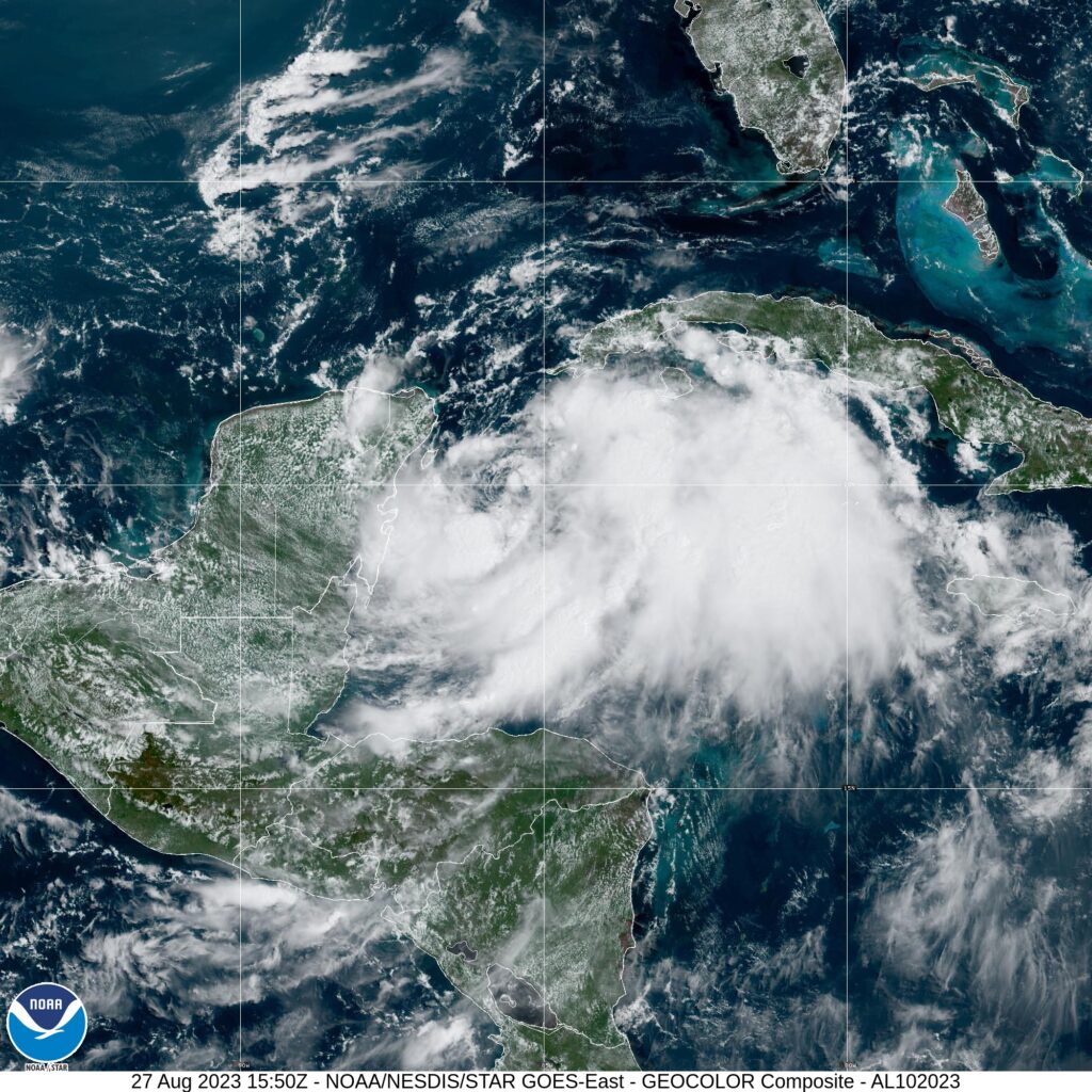
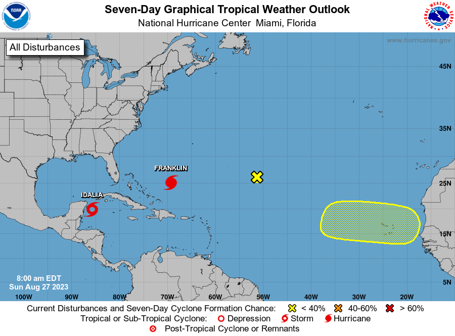
Less than 24 hours after convalescing into Tropical Depression 10, Idalia has strengthened to the 10th named storm of the 2023 North Atlantic Hurricane Season this morning (August 27).
The Caribbean coasts of Mexico and western Cuba find themselves in the immediate crosshairs of Tropical Storm Idalia, which the US-based National Hurricane Center (NHC) expects will reach hurricane intensity before slamming into the western coast of Florida.
Authorities in respective countries have activated a tropical storm warning for the Yucatán Peninsula from Tulum to Rio Lagartos, including Cozumel island in Mexico, and Pinar del Rio in Cuba.
Additionally, a tropical storm watch remains in effect for Isla de la Juventud, Cuba.
As at 10:00 am Central Daylight Time (CDT), the centre of Idalia was located near latitude 19.9 North, longitude 85.8 West—or roughly 135 kilometres east-southeast of Cozumel, Mexico.


She is packing maximum sustained winds near 55 kilometres, with higher gusts and is slowly inching east at four kilometres/hour. On the forecast track, NHC meteorologists anticipate Idalia is likely to meander near the Yucatán Channel through tonight. The tropical storm will increase its motion speed before turning north Monday, bringing the system over the eastern Gulf of Mexico.
Tropical Storm Idalia threatens to drench eastern portions of the Yucatán, with isolated maximum rainfall totals of six inches, and up to 10-inch highs in western Cuba.
The NHC says conditions are good for Idalia to roar to hurricane status by early Wednesday morning before direct landfall on Florida’s Gulf coast—maintaining tropical storm strength on its trek through southern US states including Georgia and the Carolinas next weekend.
Farther north, Hurricane Franklin is expected to become the season’s first major cyclone as it readies to undergo a rapid intensification phase in the coming hours.

Satellite imagery pinpointed Hurricane Franklin near latitude 25.1 North, longitude 69.3 West—or 445 kilometres north-northeast of Grand Turk Island—as at 11:00 am Atlantic Standard Time (AST).
The behemoth, which NOAA’s Hurricane Hunter aircraft finds has strengthened over the past 24 hours, now packs maximum sustained winds at 155 kilometres/hour, with higher gusts.
Franklin is moving toward the north-northwest near 13 kilometres/hour. Hurricane-force winds extend outward up to 35 kilometres from its centre, while tropical storm-force winds extend further outward, up to 220 kilometres.
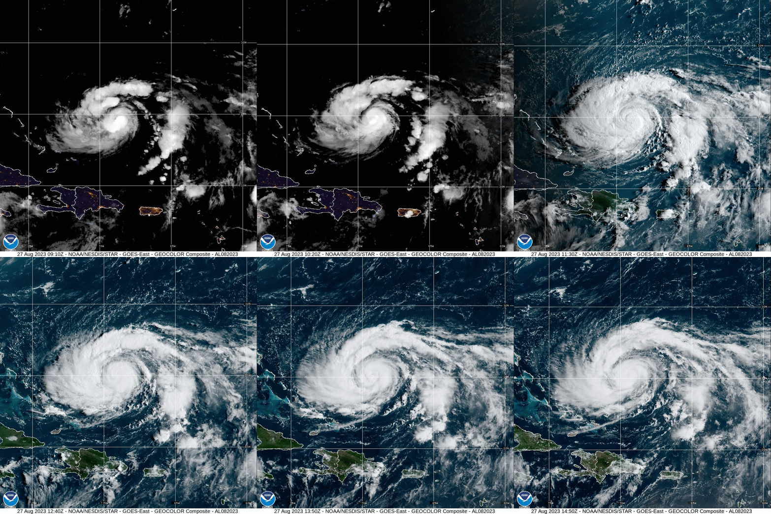
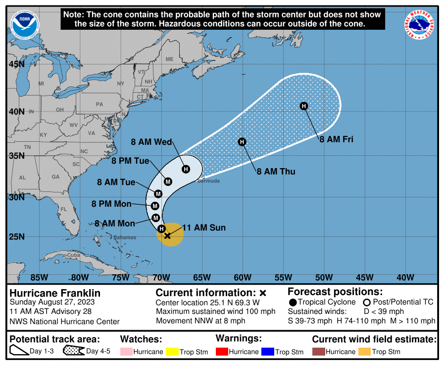
Since inundating sections of Hispaniola and Puerto Rico, as well as notching a direct death in the Dominican Republic, Hurricane Franklin currently poses no threat to land at this time. Projections place the system just west of Bermuda as it barrels like a slingshot northeast.
NHC sleuths are also tracking two disturbances with contrasting prospects.
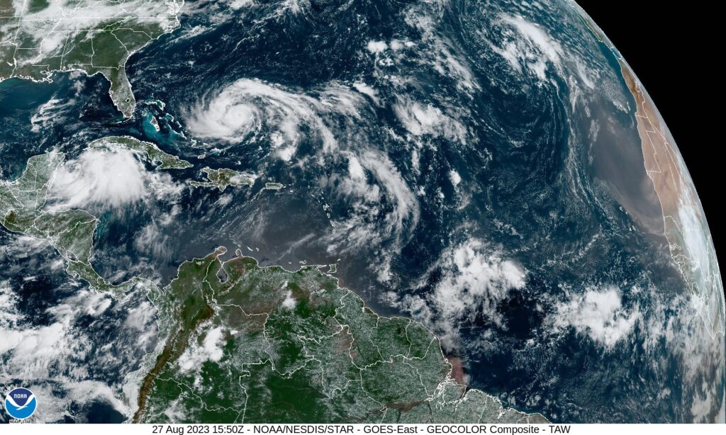
The first system, designated InvestAL92, is a trough of low pressure that has seen its potential plummet overnight. Forecasters no longer foresee any development, evidenced by its zero per cent chance, as it moves slowly northwestward to north-northwestward over the central
subtropical Atlantic over the next couple of days.
Oppositely, a tropical wave is forecast to move off the west African coast in 48 hours. Meteorologists indicate that some slow development of this system is possible later this week while the system moves westward across the eastern tropical Atlantic.
Formation chances are ‘low’ at 20 per cent in the next seven days.
The next two available names in the 2023 Hurricane Season list are Jose and Katia.






Comments