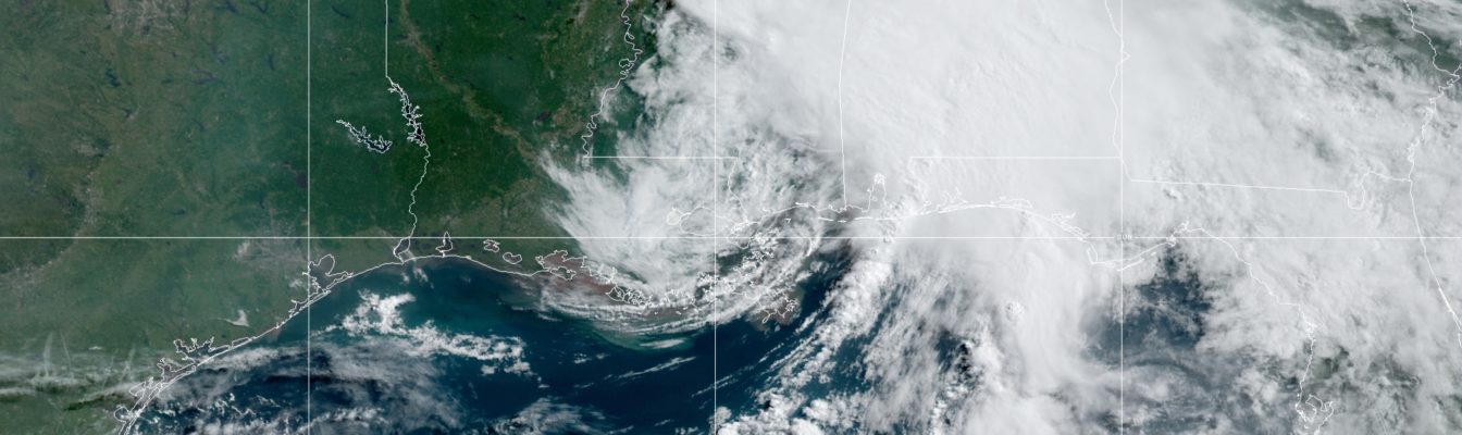
Before slamming Louisiana, Tropical Storm Claudette forms

Gavin Riley / Our Today
administrator
Becoming the third named system of the 2021 North Atlantic Hurricane Season, Tropical Storm Claudette is dumping torrential rains and strong winds in southern Louisiana on Saturday (June 19).
Tropical Storm Claudette formed at 4:00 am Central Daylight Time (CDT), mere hours before slamming the US Gulf Coast.
According to the Florida-based National Hurricane Center (NHC), as at 7:00 am CDT, the eye of Claudette was located at latitude 30.4 North, longitude 90.1 West—or roughly 45 kilometres north of New Orleans.
Claudette is moving north-northeasterly at 19 kilometres/hour and is packing maximum sustained winds remain near 75 kilometres/hour, with higher gusts.
A tropical storm warning remains in effect for the stretch of the Gulf Coast east of Morgan City, Louisiana to the Okaloosa/Walton County line Florida, as well as Lake Pontchartrain, Lake Maurepas, and Metropolitan New Orleans.
While not a fully-fledged hurricane, NHC forecasters still expect Claudette to pack a punch with up to an isolated maximum amount of 15 inches of rainfall across portions of the central Gulf Coast.
“Life-threatening flash flooding impacts are possible across coastal Mississippi and Alabama, and the far western Florida Panhandle through the afternoon. Considerable flash, urban and small stream flooding impacts, as well as new and renewed minor to isolated moderate river flooding, are likely across the remainder of the Central Gulf Coast,” the NHC advised.

The hurricane watchdog agency anticipates Claudette to make a turn toward the northeast later today, followed by a motion toward the east-northeast tonight or Sunday.
After leaving the Eastern Seaboard around Monday, the NHC added that the remnants of Claudette will again strengthen in the western Atlantic.
“On the forecast track, the system should move farther inland over Louisiana during the next few hours, then move across portions of the southeastern states later today and Sunday, and over the western Atlantic Ocean on Monday,” the forecast said.
“Claudette is expected to weaken to a tropical depression by tonight and become a post-tropical cyclone on Sunday. The system is forecast to become a tropical storm again over the western Atlantic Ocean on Monday,” the NHC added.





Comments