Tropical Storm Fay strengthens over open Atlantic, no threat to land or Caribbean

/ Our Today
administrator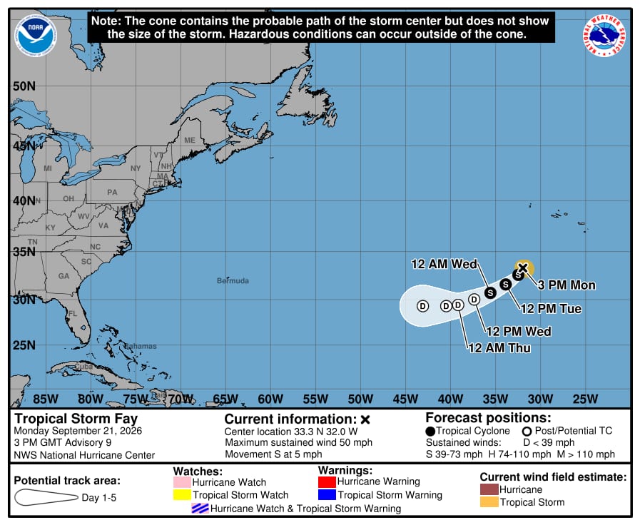
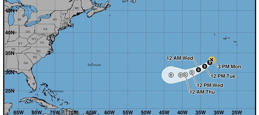
Tropical Storm Fay strengthened over the open Atlantic on Sunday, but the National Hurricane Center (NHC) says it poses no hazard to land and no coastal watches or warnings are in effect.
At 3 p.m. GMT (10 a.m. in Jamaica), yesterday Fay was centred near 34.1°N, 33.0°W, about 430 miles southwest of the Azores and far from the Caribbean. Maximum sustained winds had climbed to 60 mph, up from 45 mph in the NHC’s 9 a.m. GMT advisory. The storm was moving northeast at 3 mph. [figures from NHC Advisory 5; refresh before publishing]
Fay is a small system. Tropical-storm-force winds extend only about 45 miles from its centre, the NHC said. Forecasters expect further strengthening over the next day, helped by a moist environment and an approaching upper-level trough, and said the storm could approach hurricane strength Sunday night. The NHC’s forecast peaks at 70 mph, just short of the 74 mph hurricane threshold.

That changes Monday. Once the trough lifts, wind shear and dry air are expected to weaken Fay, and a building ridge to the north should turn it southwest. The NHC expects the storm to become a post-tropical remnant low by Tuesday and dissipate by the end of the week.
Fay is the sixth named storm of the 2026 Atlantic season, and the NHC listed no other Atlantic system with active advisories. In the Eastern Pacific, Tropical Storm Odalys formed early Sunday well southwest of Baja California with 40 mph winds, moving northwest at 8 mph. Odalys is in a separate basin from the Caribbean.
NOAA’s outlook, issued Aug. 6 and still linked from the NHC home page, calls for 7 to 13 named storms, 2 to 6 hurricanes and up to two major hurricanes, with a 75 per cent chance of below-normal activity. A typical season produces 14 named storms, seven hurricanes and three major hurricanes. El Niño, which NOAA confirmed in June, tends to suppress Atlantic development. The season runs through Nov. 30.






Comments